 Paikkatietohakemisto
2 m
Type of resources
Topics
Provided by
Years
Formats
Representation types
Update frequencies
Scale
Resolution
-
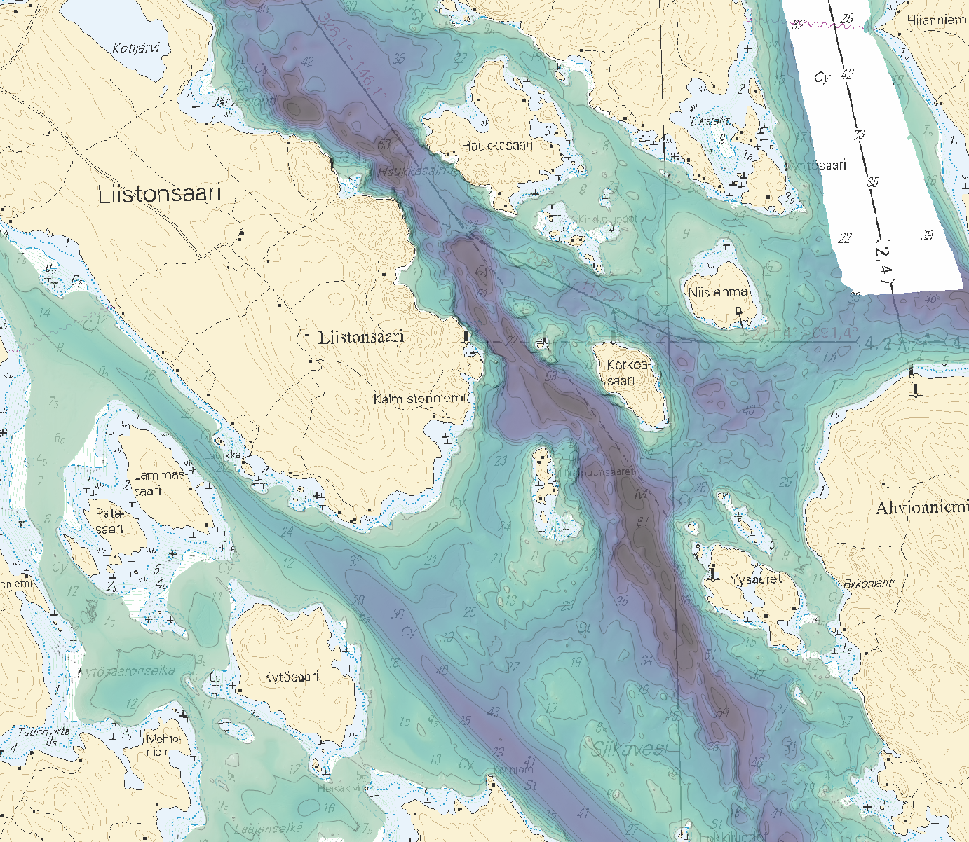
Ei toistaiseksi saatavilla. Liikenne- ja viestintävirasto Traficomin syvyysmittausaineistojen latauspalvelu on WCS-standardin mukainen latauspalvelu, jonka kautta on mahdollista ladata rasterimuodossa (GeoTIFF) julkisia syvyysmittausaineistoja sisävesiltä ja aineiston täydentyessä myös merialueelta talousvyöhykkeeltä. Palvelu on tarkoitettu WCS (Web Coverage Service) -standardia tukevien sovellusten käyttöön. Rasteriaineistot tarjotaan ETRS-TM35FIN (EPSG:3067) -projektiossa tiilitettyinä 10 x 10 km:n ruutuihin keskiarvopintamallina 2 x 2 m:n spatiaalisessa resoluutiossa. Palvelu perustuu Traficomin syvyysmittausaineistoon. Palvelussa oleva aineisto päivittyy syvyyspisterekisterin täydentyessä. Palvelun kautta saatavilla olevia aineistoja ei ole tarkoitettu navigointikäyttöön, eivätkä ne täytä asianmukaiselle merikartalle asetettuja vaatimuksia.
-
The themes of the Topographic database and Topographic map raster series (scale 1:10,000) have been compiled into seven theme entities, theme rasters, required by the Inspire directive: hydrography, elevation, traffic network, land use, land cover, place names and buildings. In addition to the above, the theme rasters also include the municipal division, road names and map sheet division as separate themes. The theme rasters have not been implemented according to the imaging technology defined in the Inspire directive. They will be produced later. The product belongs to the open data of the National Land Survey of Finland.
-
Elevation model 2 m is a model depicting the elevation of the ground surface in relation to sea level. Its grid size is 2 m x 2 m. The dataset is based on laser scanning data, the point density of which is at least 0.5 points per square metre. The product's coverage is based on nationwide laser scanning. In some parts of the outer archipelago or the eastern border, the elevation model is not available. Elevation model 2 m is produced in two quality classes: the elevation accuracy in class I is on average 0.3 metres and the elevation accuracy in class II varies between 0.3 metres and one metre. The product belongs to the open data of the National Land Survey of Finland.
-
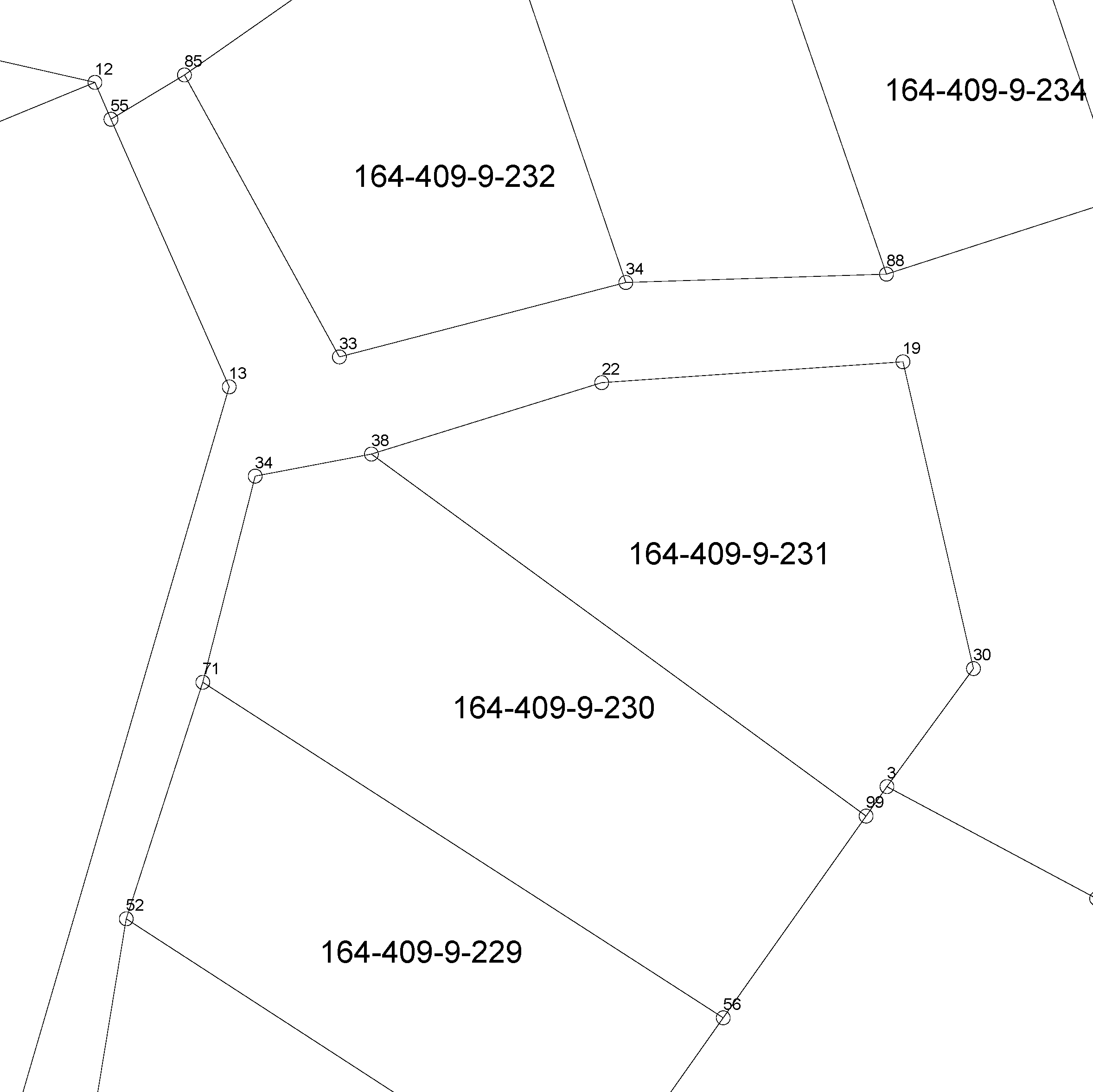
The location of the real property unit is shown on the cadastral index map. On the map, there are property and other register unit boundaries and property identifiers. The product is a part of the open data of the National Land Survey. Further information (in Finnish): http://www.maanmittauslaitos.fi/kiinteistot/asiantuntevalle-kayttajalle/kiinteistotiedot-ja-niiden-hankinta
-
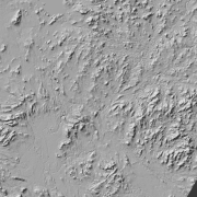
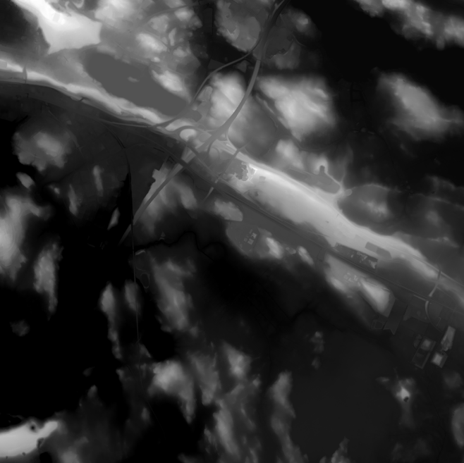
Hillshade (elevation model) is a raster dataset visualising the elevation of the terrain. There are five product versions available in which the pixel sizes are 2, 8, 32, 64, 128 and 512 metres. Pixel size 2 m has been produced of the dataset Elevation model 2 m. The other sizes have been produced of the dataset Elevation model 10 m. The material does not contain elevation values; it is a greyscale image that visualises the direction and steepness of hills. The product belongs to the open data of the National Land Survey of Finland.
-

The Background map is a dataset product series in raster format that depicts the whole of Finland and that is meant for web use as a background material for thematic data. Its key objects are road names, roads and railways, buildings and constructions, administrative borders, geographical names, waterways, land use and addresses of buildings (from the Digital and Population Data Services Agency). The product belongs to the open data of the National Land Survey of Finland.
-
The Plain map series is a simple, plain and readable dataset product series in raster format that depicts the whole of Finland. The product is meant to be used as a background map whose character changes to a guide map in large scales. Impaired vision has been taken into account when designing the product. The key objects presented on the map are roads and railways, road names, buildings and constructions, administrative borders, waterways and other geographical names. The road network, public buildings and texts have been especially emphasised. The most usual limitations of colour vision have been taken into account in the use of colours. The product belongs to the open data of the National Land Survey of Finland.